What I have learned researching wild fires over the past few days.
There are many types of wild fires:
https://theconversation.com/does-fuel-reduction-burning-help-prevent-damage-from-fires-11600?fbclid=IwAR3TRtRjbcFlr0c7hhTtK8u_ZRt-OKH4q9nmrZ5gRjrweGeedv3ib8bABXM
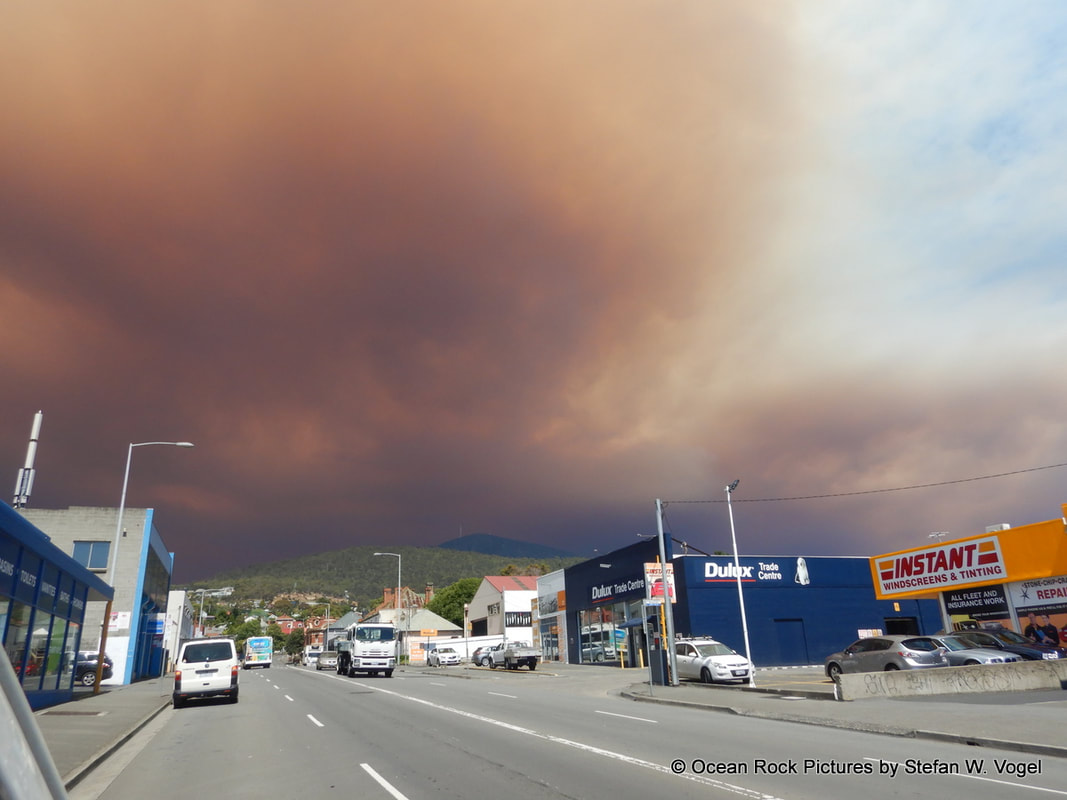
Wind and weather conditions are the main drivers of a fire spreading as well as uncertainties in controlling a fire.
Under the right conditions fires develop into catastrophic fires in which the best prepared houses with no vegetation around are not defendable. (see for example facebook post from fire.tas.gov.au on a house that burned on January 2019 at Skittle Ball Plains near Miena, details below)
Under those right conditions ember attack can ignite new fire and houses up to 20 km in front of the fire and fire can spread catastrophically fast well ahead of the actual fire front.
Under the right conditions fire can sweep through urban areas which were previously thought to be immune to wild fires. (examples Dunnalley, Santa Rosa – California https://www.news.com.au/technology/environment/homes-destroyed-residents-killed-as-explosive-wildfires-burn-california-wine-country/news-story/716d34dc4a45c2414b0e048cc59ce9ff).
Under those right conditions a city like Hobart will not be defendable and bear the need for mass evacuation.
Northerly winds with hot air flowing from mainland Australia to Tasmania leading to temperatures in the high 30’s (up to about 40 degree in 2013) make for uncontrollable catastrophic bushfire conditions.
While there is an escape route across the river in Hobart, such conditions put Kingston, Blackmans Bay at a very high risk, as access road (Southern Outlet, Huon Highway) may become blocked and Tinderbox, Margate area would be threatened at the same time.
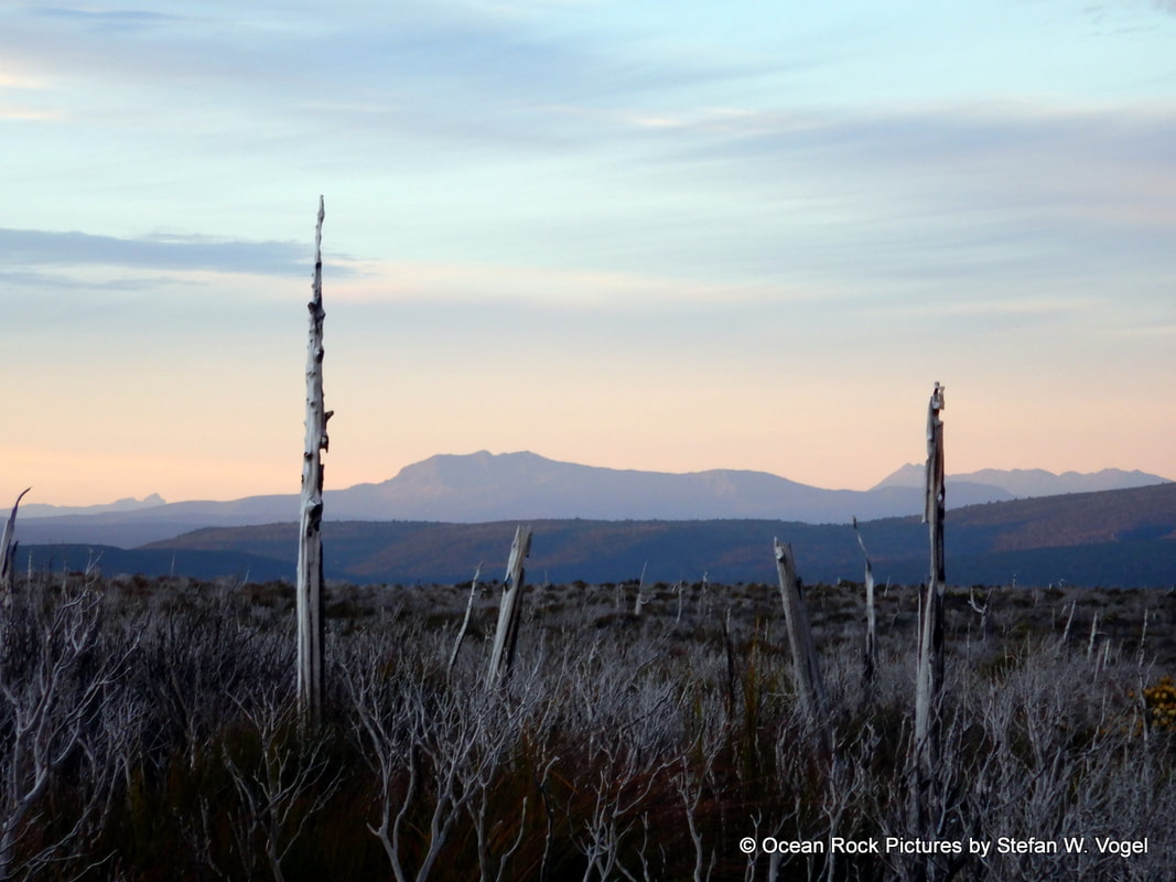
- Ground fires which consumes shrubs, grasses
- Tree Crown fires that burn the crown of the trees.
https://theconversation.com/does-fuel-reduction-burning-help-prevent-damage-from-fires-11600?fbclid=IwAR3TRtRjbcFlr0c7hhTtK8u_ZRt-OKH4q9nmrZ5gRjrweGeedv3ib8bABXM
Wind and weather conditions are the main drivers of a fire spreading as well as uncertainties in controlling a fire.
Under the right conditions fires develop into catastrophic fires in which the best prepared houses with no vegetation around are not defendable. (see for example facebook post from fire.tas.gov.au on a house that burned on January 2019 at Skittle Ball Plains near Miena, details below)
Under those right conditions ember attack can ignite new fire and houses up to 20 km in front of the fire and fire can spread catastrophically fast well ahead of the actual fire front.
Under the right conditions fire can sweep through urban areas which were previously thought to be immune to wild fires. (examples Dunnalley, Santa Rosa – California https://www.news.com.au/technology/environment/homes-destroyed-residents-killed-as-explosive-wildfires-burn-california-wine-country/news-story/716d34dc4a45c2414b0e048cc59ce9ff).
Under those right conditions a city like Hobart will not be defendable and bear the need for mass evacuation.
Northerly winds with hot air flowing from mainland Australia to Tasmania leading to temperatures in the high 30’s (up to about 40 degree in 2013) make for uncontrollable catastrophic bushfire conditions.
While there is an escape route across the river in Hobart, such conditions put Kingston, Blackmans Bay at a very high risk, as access road (Southern Outlet, Huon Highway) may become blocked and Tinderbox, Margate area would be threatened at the same time.
Bushfire plans:
Bush fire plans on fire.tas.gov.au are limited to communities directly adjacent to bush and reserves. There is no bush fire plan for the urban parts of Hobart North Hobart, Battery Point, Kingston, Blackmans Bay, New Town, Moonah, Glenorchy, Lindisfarn, Bellerive, Howrah, Brighton, Tea Tree, Richmond or Sorell …
Many of the houses in these areas are weatherboard houses that can easily burn.
“The City of Hobart sends bushfire preparedness information to people who have bought property in parts of the Hobart municipality that are classified as bushfire prone.
Bushfire-prone properties are within 100 metres of an area of bushland that is 1 hectare or more in size.” source https://www.hobartcity.com.au/City-services/Bushfire-management/Bushfire-management-for-residents?fbclid=IwAR3RXIzA-ccbQPWMFUaJJTeU1KFolVESRvDLTyR24tnVpTTs6Da6OdpuIf8
The existing bush fire plans for Hobart City are limited to reserve bushfire management plans (BMPs) and the plans are mainly more than 10 years old. https://www.hobartcity.com.au/City-services/Bushfire-management?fbclid=IwAR1RrxyESqeKtXlkxU3Vi2m03z6W78Flz-ZVgnapz8hNU5vUm8c4RKN-fL0
Conclusions:
Should dry lightning ignite several fires in the wider Hobart/ Derwent River area, under the right catastrophic uncontrollable fire conditions large extents of the wider Hobart urban area is under threat requiring wide spread evacuations and that could devastate a large urban area all the way to and across the river. A scenario Councils in this area and emergency services should prepare for
References
Fire.tas.gov.au facebook post January 23, 2019
https://scontent-syd2-1.xx.fbcdn.net/v/t1.0-9/50255662_2504208816287208_7907839393929363456_o.jpg?_nc_cat=110&_nc_ht=scontent-syd2-1.xx&oh=00e5dff3159d2d3afad89bacac05493a&oe=5CC07DEC
A house at Skittle Ball Plains near Miena was lost to fire just before 7pm last night. The owners had a plan to stay and defend their property with the assistance of fire crews.
They had a clear space around their property, a fire pump and sprinklers on the roof.
Fire crews and the owners were defending the property from bushfire when conditions became untenable and required everyone to evacuate. Thankfully everyone involved is safe.
This photo clearly shows an unburnt area and green trees around the house, which indicates the house came under ember attack, rather than a direct impact from the nearby Central Plateau fire.
Not even seemingly defendable properties are defendable in the conditions we are facing.
Know your risk. Make a plan.
No property is worth your life.
picture Adam Doran
Bush fire plans on fire.tas.gov.au are limited to communities directly adjacent to bush and reserves. There is no bush fire plan for the urban parts of Hobart North Hobart, Battery Point, Kingston, Blackmans Bay, New Town, Moonah, Glenorchy, Lindisfarn, Bellerive, Howrah, Brighton, Tea Tree, Richmond or Sorell …
Many of the houses in these areas are weatherboard houses that can easily burn.
“The City of Hobart sends bushfire preparedness information to people who have bought property in parts of the Hobart municipality that are classified as bushfire prone.
Bushfire-prone properties are within 100 metres of an area of bushland that is 1 hectare or more in size.” source https://www.hobartcity.com.au/City-services/Bushfire-management/Bushfire-management-for-residents?fbclid=IwAR3RXIzA-ccbQPWMFUaJJTeU1KFolVESRvDLTyR24tnVpTTs6Da6OdpuIf8
The existing bush fire plans for Hobart City are limited to reserve bushfire management plans (BMPs) and the plans are mainly more than 10 years old. https://www.hobartcity.com.au/City-services/Bushfire-management?fbclid=IwAR1RrxyESqeKtXlkxU3Vi2m03z6W78Flz-ZVgnapz8hNU5vUm8c4RKN-fL0
- Ridgeway Park–Waterworks Reserves Fire Management Plan (2003)
- Knocklofty Reserve–McRobies Gully Fire Management Plan (2005)
- Queens Domain Fire Management Plan (2008)
- Bicentennial Park–Porter Hill Fire Management Plan (2014)
- Wellington Park Fire Management Strategy (2006).
Conclusions:
Should dry lightning ignite several fires in the wider Hobart/ Derwent River area, under the right catastrophic uncontrollable fire conditions large extents of the wider Hobart urban area is under threat requiring wide spread evacuations and that could devastate a large urban area all the way to and across the river. A scenario Councils in this area and emergency services should prepare for
References
Fire.tas.gov.au facebook post January 23, 2019
https://scontent-syd2-1.xx.fbcdn.net/v/t1.0-9/50255662_2504208816287208_7907839393929363456_o.jpg?_nc_cat=110&_nc_ht=scontent-syd2-1.xx&oh=00e5dff3159d2d3afad89bacac05493a&oe=5CC07DEC
A house at Skittle Ball Plains near Miena was lost to fire just before 7pm last night. The owners had a plan to stay and defend their property with the assistance of fire crews.
They had a clear space around their property, a fire pump and sprinklers on the roof.
Fire crews and the owners were defending the property from bushfire when conditions became untenable and required everyone to evacuate. Thankfully everyone involved is safe.
This photo clearly shows an unburnt area and green trees around the house, which indicates the house came under ember attack, rather than a direct impact from the nearby Central Plateau fire.
Not even seemingly defendable properties are defendable in the conditions we are facing.
Know your risk. Make a plan.
No property is worth your life.
picture Adam Doran
 RSS Feed